
| Miles from Springer | Features | Elevation |
|---|---|---|
| 70.7 | Campsite (3,150') | 3150 |
| 71.4 | Cowart Gap (2,900') | 2900 |
| 72.9 | Bull Gap (3,550') | 3550 |
| 74.1 | Plumorchard Gap Shelter (3,050')?8.6mS; 7.5mN | 3050 |
| 74.8 | As Knob (3,460') | 3460 |
| 75.4 | Blue Ridge Gap (3,020')?dirt road | 3020 |
| 76.4 | Campsite (3,500') | 3500 |
| 76.6 | Rich Cove Gap (3,390') | 3390 |
| 78.5 | Georgia?North Carolina State Line (3,825')?tree register | 3825 |
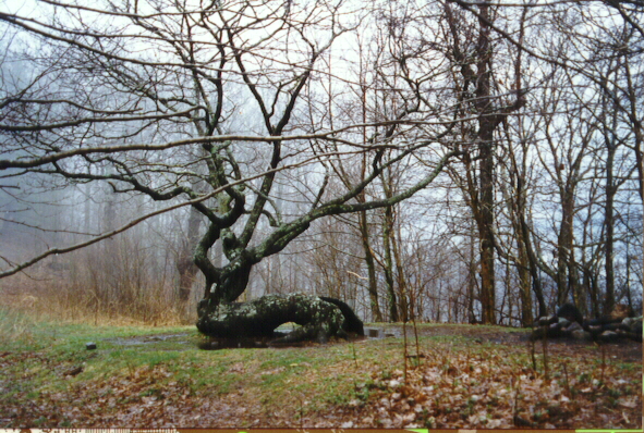
| 78.6 | Bly Gap (3,840')?gnarly oak tree | 3840 |

| Miles from Springer | Features | Elevation |
|---|---|---|
| 79.1 | Sharp Top (4,300')?vista | 4300 |
| 80.5 | Sassafras Gap (4,300') | 4300 |
| 81.4 | Muskrat Creek Shelter (4,600') ?7.5mS; 4.9mN | 4600 |
| 82.2 | Whiteoak Stamp (4,620') | 4620 |
| 82.4 | Chunky Gal Trail (4,700') | 4700 |
| 83.3 | Wateroak Gap (4,490') | 4490 |
| 85.4 | USFS 71, Deep Gap, (4,341'), Kimsey Creek Trail to USFS Standing Indian Campground | 4341 |
| 86.3 | Standing Indian Shelter (4,760') ?4.9mS; 7.6mN | 4760 |


| Miles from Springer | Features | Elevation |
|---|---|---|
| 86.3 | Standing Indian Shelter (4,760') ?4.9mS; 7.6mN | 4760 |
| 87.8 | Lower Trail, Ridge Trail (5,498') Standing Indian Mountain | 5498 |
| 90.7 | Beech Gap Trail, Beech Gap (4,460') | 4460 |
| 92.4 | Coleman Gap (4,200') | 4200 |
| 93.5 | Timber Ridge Trail (4,700') | 4700 |
| 93.9 | Carter Gap Shelters (4,540') ?7.6mS; 8.6mN | 4540 |

| Miles from Springer | Features | Elevation |
|---|---|---|
| 93.9 | Carter Gap Shelters (4,540') ?7.6mS; 8.6mN | 4540 |
| 94.9 | Ridgepole Mountain (4,990') | 4990 |
| 97.6 | Betty Creek Gap (4,300') | 4300 |
| 98.5 | USFS 83, Mooney Gap (4,400') | 4400 |
| 98.8 | Spring (4,500') | 4500 |
| 99.3 | Bearpen Gap (4,700') | 4700 |
| 99.8 | USFS 67, Bearpen Trail (4,790') | 4790 |
| 100.1 | Albert Mountain (5,250')?firetower | 5250 |
| 102.5 | Long Branch Shelter (4,503') ?8.6mS; 3.5mN | 4503 |
| 103.5 | Glassmine Gap, Long Branch Trail (4,400') | 4400 |
| 106 | Rock Gap Shelter (3,760')?3.5mS; 8.5mN | 3760 |
| 106.1 | USFS 67, Rock Gap (3,750') USFS Standing Indian Campground | 3750 |
| 106.7 | Old U.S. 64, Wallace Gap (3,738') | 3738 |
 |  |  |